Flood maps weren’t created with homebuyer protection in mind
CHRIS TOMLINSON Commentary

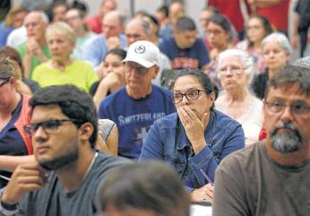
A meeting at Lee Elementary last month focused on flooding caused by the Addicks Reservoir.
Melissa Phillip / Houston Chronicle
How do flood maps fail home-buyers? Let me count the ways. First and foremost, determining flood risk has as much to do with politics and economics as it does with science. And even the scientific data can be cherry-picked.
Most of Texas’ flood plain maps, including Fort Bend County’s, are based on 50-year-old rainfall data, according to an investigative report by my Chronicle colleague Ryan Mae Handy. And the newer maps, like the one for Harris County, are the product of negotiation and compromise, not the best science.
Most Houston-area home-buyers will be surprised to learn that they invested their life savings relying on flood maps shaped by greedy developers eager to make a quick profit and government officials desperate to promote economic development.
In Fort Bend’s case, flood modeling is based on rainfall averages computed in 1961 to calculate the 100-year flood plain. Any old-timer, though, knows that the worst drought in Texas history lasted from 1949 to 1957, Texas’ driest period in 600 years. Lower rainfall averages, though, lead to smaller flood plains, more land development and fewer homeowners buying flood insurance.
Those eight years of drought likely distorted rainfall expectations, which means so-called 500-year rain events like the Memorial Day 2015 and Tax Day 2016 floods are likely far more common than we think.
A mix of federal, state and local officials is responsible for updating flood maps, but it’s an expensive process. Congress promised the Federal Emergency Management Agency $200 million to update the nation’s maps but then cut the funding and slowed progress. The Texas Legislature has declined to pay for new maps, and county officials certainly don’t have the money.
That partially explains why only 10 out of 29 counties flooded by Hurricane Harvey have updated maps. The deeper answer is that major landowners, particularly real estate developers, are terrified that their land could end up inside a revised flood plain, instantly devaluing their property. One way to keep your property out of a flood zone is to discourage government agencies from updating maps.
Tropical Storm Allison forced Harris County to update maps in 2001 using newer data. But the process does not end with simply running new models using the latest topographical information and rainfall data. Draft maps then go through a 90-day review and comment period where landowners and community leaders can redraw them.
“Officials are concerned about the financial burden on individual property owners, but also worry about decreased property values and increased restrictions on development,” writes Sarah Pralle, an associate professor at Syracuse University who is studying the mapmaking process nationwide. “Community negotiations with FEMA can result in significant changes to the final map.”
That’s why so many homeowners found themselves knee-deep in water during Hurricane Harvey when their homes were supposedly outside the flood plain. Not to worry, though. A flooded home can still remain outside the official flood plain. Property owners can appeal directly to the Federal Emergency Management Administration.
A 2014 investigation by NBC News found that FEMA redrew maps to benefit at least 500 wealthy homeowners, eliminating their requirement to buy flood insurance even though the homes had flooded repeatedly. The property owned by low-income neighbors, by the way, often remained in the flood plain.
Because the mapmaking is negotiable and centered on reducing flood insurance requirements while boosting land values, the process can “lead to misleading maps that underestimate the likelihood and severity of flood risk and provide individuals outside the designated zone with a false sense of security,” Pralle wrote.
The law also differentiates between flood plains and flood pools, as homeowners living near the Addicks and Barker reservoirs learned. A flood pool is not regulated, and property sellers were not required to disclose that the U.S. Army Corps of Engineers could inundate nearby neighborhoods in an emergency.
“We were able to save our closing documents, and I’ve had time to review them. There was nothing in the documents or in the title search about any flood pools or inundation by being at the back of the reservoir,” Canyon Gate homeowner Douglas Brewer told Chronicle investigative reporter James Drew.
Homebuyers rely on disclosure documents and flood maps to make informed purchases, but that faith is clearly misplaced. The current system of identifying flood risk is deeply flawed and favors developers and government officials at the expense of consumers.
New maps alone will not ensure that homebuyers understand the risk to their homes. We need to revise the system to make sure it assesses actual risk based on the best available science and eliminates the opportunity for property owners to game it.
Chris Tomlinson is the Chronicle’s business columnist. chris.tomlinson@chron.com twitter.com/cltomlinsonwww.houstonchronicle.com/author/chris-tomlinson